|
|||
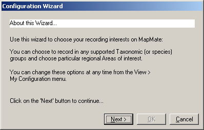
Configuration Wizard
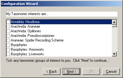
You start by specifying the groups of organisms that you are intending to record (e.g. Vascular Plants, Lepidoptera, Birds etc.). MapMate is supplied with an extensive list (Taxa Library) of over forty thousand species names, it makes selection quicker if you have only the ones that you expect to need in your working list. This list is called 'My Taxa' in MapMate. You are able to exclude (or hide) any species groups from 'My Taxa' using settings called 'Defaults', so it may be best to include all those you think you may use at some stage as they can be excluded while they are not needed. In the 'My Taxonomic interests are...' form of the 'Configuration Wizard' select any groups of animals or plants that you will be recording by clicking on the check-boxes to the left of their names. You can move down the list using the scroll bar to the right of the list. (Taxonomy is the study of the classification of living things. The term Taxon is used instead of Species in MapMate as it can include sub-species or it could be the name for an aggregate of species that cannot easily be separated).
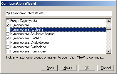
Some groups have subdivisions, if you select a main group, all the Taxa within its subdivisions will be included in the 'My Taxa' list and be available for you to record. However if you want to be able to select the subdivisions when you set your 'Defaults' (to restrict the range of records for Analysis or to match species names in Data Entry) you need to include the subdivision(s) at this stage. For example, if you are collecting records for the Bees, Wasps and Ants Recording Scheme (BWARS) you should select 'Hymenoptera: BWARS'. If you wish to record all Hymenoptera and also be able to select out those to be sent to the BWARS scheme, you should select both 'Hymenoptera' and 'Hymenoptera: BWARS'.
You can run the 'Configuration Wizard' again subsequently to make changes in your 'My Taxa' list if you find you have omitted any groups that you later wish to record.
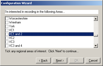
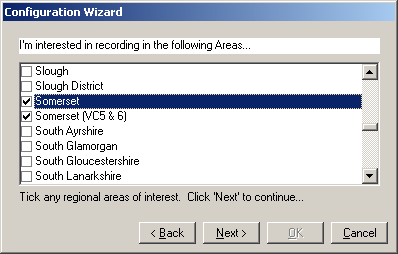
The list includes modern Administrative County, Unitary Area and Metropolitan Area names and the numbers of Watsonian and Irish Vice-Counties.
Vice-Counties are a system of dividing the British Isles into approximately equal areas based on County boundaries, as they were in Victorian times, when the system was established (e.g. Somerset is divided into two Watsonian Vice-Counties, 5 is South Somerset and 6 is North Somerset). The Vice-Counties are listed in MapMate by their standard numbers, those preceded by 'H' are in Ireland (Hibernian?). Unlike modern Administrative Areas the boundaries of Vice-Counties are not subject to change by politicians.
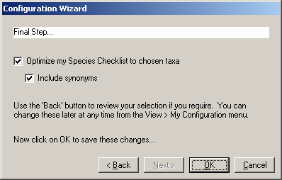
When you have selected your recording areas click 'Next>' and then 'OK' in the 'Final Step...' form. Leave the default options ticked unless you do not want your Checklist to include synonyms (old scientific names that some people may still use after a change in scientific names of a group).
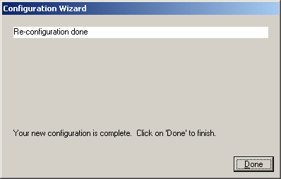
Click 'OK' and you will be asked to wait while your system is configured, then click the 'Done' button on the final form.
MapMate then brings up the help Screen with an invitation to read the 'Quick Start Guide'. This gives instructions for setting up MapMate and starting to enter your data, as described in the following section.
|
|||
|
Copyright © Teknica/Merrifield 2003. All Rights Reserved. MapMate® Home |