|
|||
Setting Up MapsSetting up a New AtlasThe Base Map that you have set up for your area is used as the basis for the maps of the Taxa (species) that you will recorded, these maps are held in an Atlas. An Atlas consists of a Base Map over which are plotted a series of 'Features', which can include Taxon records, boundaries, or background graphics. The next stage is to create a new Atlas for the group of species that you are going to record (if you record in a number of different groups you can later set up individual Atlases for each).
From the MapMate Main screen select the 'File' menu then 'New Map' > 'Atlas Wizard'.
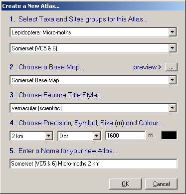
Having selected your county you then select the Base Map for that county that you made previously (e.g. 'Somerset Base Map'). The
'Preview >'
Choose the style you prefer for the names of the species from the 'Choose Feature
Style' list, you can select from a number of arrangements of scientific and/or vernacular (common) names. From the list in the 'Symbol' field choose the shape of the symbol to be used on the map, a 'dot' is usual. The 'Size' field controls the size of the symbols on the map, too large and they could overlap and too small and they may not be visible on the map. Leave it at the default 1600 meters for this example. You can select the colour of the symbols by clicking in the coloured box at the end of the row of fields and selecting a colour from the palette that appears. The 'Enter a name for your New Atlas...' field will contain a default name combining your Taxa group, locality and precision, you can edit this name. Click 'OK' and MapMate will set to work to create your new map.
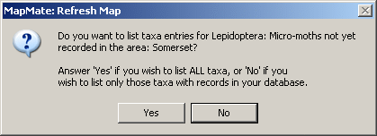
You will then be asked if you wish to list ALL Taxa, including those not recorded, click 'Yes' for your first map. Normally, when you have entered some data, you would select 'No' so that the list of Taxa available for mapping shows only those that you have recorded. During the initial set up, when there are no records in your database, you have to select 'Yes' as the Map Refresh procedure will fail if no Taxa are available.
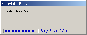
MapMate then compiles the Atlas and asks you to wait while the Atlas is being generated.
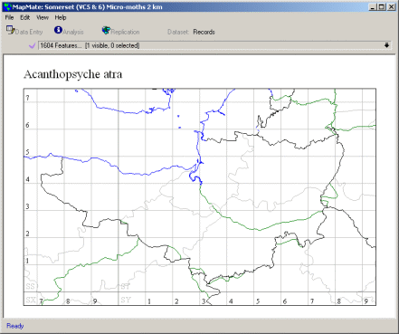
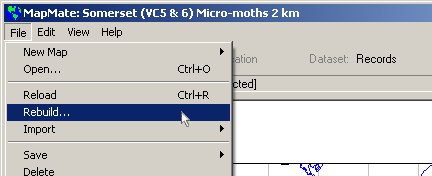
When the Atlas has been generated it will default to a Taxon in your selected group, but no dots will show on the map as you have not entered any data yet. When you have entered records for a Taxon they will appear on the map if you select that Taxon from the 'pull-down' 'Features list' above the map. Other recorder's records will also be shown on your map after you Synchronise your data with other users. When you have made your first Atlas, before you have entered data for that group, the 'pull-down' 'Features list' above the map will list the names of all Taxa in your chosen group. Rebuilding AtlasesWhen you have entered records you will probably prefer the list to show only the Taxa for which you have records instead of all those included in your Checklist. If you want to change this you can open the map and go to the 'File' > 'Rebuild' menu to rebuild the map then answer 'No' to the question about "Do you want to list taxa entries for ..." so that the list above the map will then show only those Taxa for which you have records.
Note: If you have made an atlas with all species there is no need to 'Rebuild' to see new records - these are added to a map automatically by data entry. The original versions of MapMate had simple vector maps, from Version 2.0 onwards MapMate incorporated Digital Maps licensed from (c) Bartholomew 2003. The maps are designed to give good results at UK, Regional, County, District and Vice County - if you wish to record in a very small area then you may wish to create a custom map and add your own boundary data - see Advanced Topics in online support.
|
|||
|
Copyright © Teknica/Merrifield 2003. All Rights Reserved. MapMate® Home |